Stunning visualizations
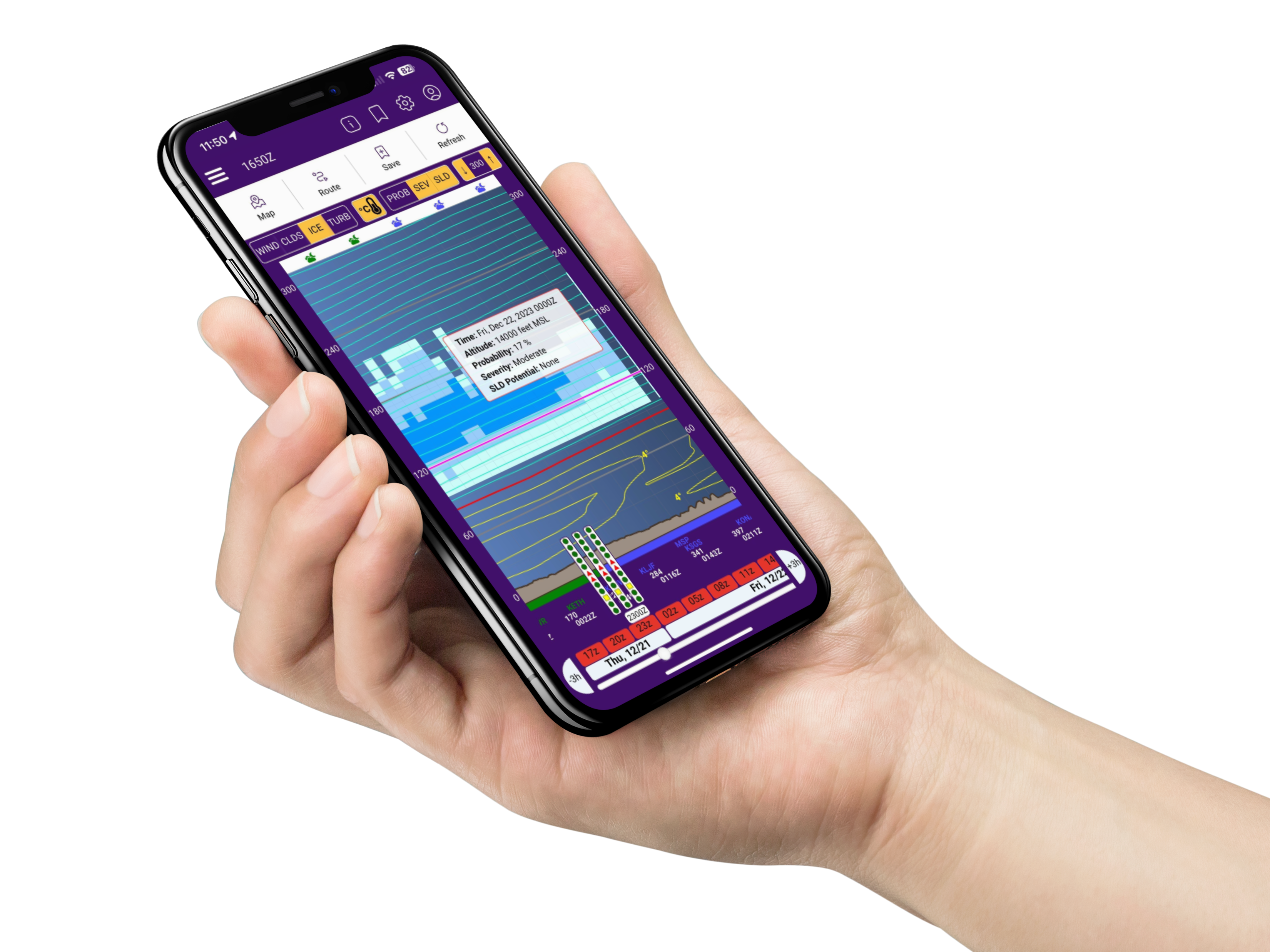
Limiting your exposure to adverse weather on any proposed flight is often a function of choosing the right altitude. Whether flying under visual or instrument flight rules, the EZWxBrief vertical route profile you will be able to quickly visualize the icing, turbulence and wind as a function of altitude. This depicts a vertical cross-section of the weather along your route in a way that allows you to instantly see the location and height of clouds and where there’s a risk of icing, turbulence, convection and IFR conditions. Moreover, pilots flying VFR will be able to easily know their exposure to instrument meteorological conditions (IMC). So are you ready to minimize your exposure to adverse weather and enjoy the simplicity of EZWxBrief?